





4.3
Free
GPS Drone
GPS Drone - A Comprehensive Drone Control App


Safe & trusted downloads
The best software, verified by experts
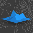
Relief Maps - 3D GPS Hiking Trail Running Ski
Relief Maps is a free Android application that offers 3D maps of the entire world on your smartphone. It is perfect for planning your next hike, trail, or trek. With just a few clicks, you can get all the necessary information, such as distance, elevation, and estimated time.
One of the most useful features of Relief Maps is the ability to share your location in real-time, which is great for keeping your loved ones informed about your whereabouts. You can also download your favorite maps and routes for offline use, so you can browse them even without an internet connection.
Relief Maps offers global coverage, allowing you to explore roads and trails all around the world. It also provides USGS maps, including topo maps and satellite imagery, for even more accurate information. Additionally, Relief Maps is compatible with Strava, allowing you to log in to your account and view all your tracks in 3D. Lastly, you can record or import your tracks and replay them in 3D, which is a great way to share your performances.
Free
GPS Drone - A Comprehensive Drone Control App

Free
Xem vị trí sổ hồng: An Intuitive Tool for Real Estate Location

Free
A free program for Android, by Guri App Tecnologia ME.
Free
Gati Shakti Asset Mapping: An Android App for Asset Survey

Free
A free app for Android, by KSRSAC KGIS.

Free
A free app for Android, by Appsence Technologies CO. LTD.

GeoTrack360: GPS Phone Locator Review

A free program for Android, by Electrify America.

Wassalni - Real-time Vehicle Tracking App

Effortless Charging with Aral pulse
GPS Area Measure - An Indispensable Tool for Users Who Plan to Develop Land in Areas

Ultimate Maritime Navigation Support App

Convenient Charging Solution for Electric Vehicles

광주버스 - 종결자

Rider Partner Oaer - A Travel Companion for OAER Cab Drivers
A free program for Android, by Antyi.

德安航空App Services Overview