

4.7
Free
Agrar Wetter
A free app for iPhone, by Bayer Aktiengesellschaft.


Safe & trusted downloads
The best software, verified by experts
<h2>Model-driven local forecasts for planners, pilots, and outdoor pros</h2>
Planning a hike, scheduling a flight, or timing irrigation, meteoblue weather & maps from meteoblue AG targets people who need model-driven local forecasts. The app combines numerical weather models with AI post-processing to produce high-resolution predictions and interactive map visualizations for temperature, wind, and precipitation. It offers model comparison, a where2go Sun Finder, rainSPOT, METAR data, and severe-weather alerts for outdoor enthusiasts and professionals who need precise local insight.
The app blends several global numerical weather models with proprietary AI post-processing to refine forecasts down to 10 meters, and it exposes that process through a MultiModel comparison. Users can check agreement between models to judge forecast certainty. Key visuals include high-resolution meteograms for temperature, wind, and precipitation, plus the rainSPOT indicator that maps precipitation distribution around a chosen point.
The app supports iPhone, iPad, and Apple Watch and provides specialized aviation data such as METAR reports for airports, so it fits into on-the-go professional routines. It requires iOS 14.0 or later for the latest features. Offline mode caches data from recent location queries for use when reception drops, and push notifications deliver severe weather alerts directly to the device and wrist for timely warnings.
Interactive weather maps include live rain radar, satellite overlays, and animated wind fields that help pick safe routes or meeting spots. The where2go Sun Finder scans nearby terrain to locate sunnier microclimates, useful for day trips. Apple Watch support brings current conditions and rainSPOT warnings to the wrist, which is practical when users are away from a phone screen.
Professionals in aviation, agriculture, and renewable energy gain model-based detail and METAR data that match operational needs; outdoor planners and hikers get localized radar and meteograms for trip timing. The app's scientific orientation and exposed model differences make it a practical tool for people who must assess forecast certainty rather than rely on a single summary value.
To sum up, the app is a strong choice for professionals and serious planners who need model-backed precision and the ability to judge forecast certainty, since it exposes model outputs and refines forecasts to near-surface scales. Casual users who prefer minimal, glanceable summaries may find the scientific detail more than they need; consider a simpler weather glance tool for quick daily checks.

Pollen Wise - The Only App That Gives You a Snapshot of Air Quality
A free Weather app for iOS

The Weather Network: Personalized Weather Experience
Volcanoes: Map, Alerts & Ash - The Most Reliable and the Most Accurate Tool for Volcanoes Lovers
墨迹天气-MojiWeather: The Weather App That Cares for You
Moon Calendar Plus Is Your Guide To Moon Sighting
Moon Phases and Lunar Calendar for iphone from Business City s.r.o.
A free Weather app for iOS
The Wetter.com App for iPhone and iPad
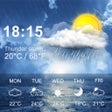
Accurate Weather Forecast App with Widgets